Facts
Carroll County, Indiana
Carroll County is located in mid-northwestern Indiana, 19 miles from I-65. 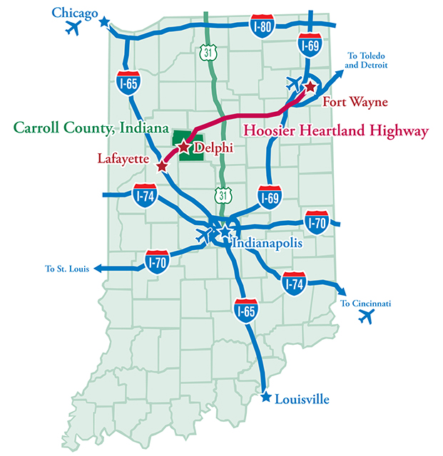
It is the crossing site for seven (7) highways, two (2) rail lines, and the new Hoosier Heartland Corridor. Carroll County is strategically located for workers, with a population of 360,000 people in the immediate surrounding counties. Carroll County is also within at five-hour drive of nearly 53,000,000 others.
Travel time from major areas
Lafayette, Indiana - 30 minutes / 18 miles
West Lafayette, Indiana - 40 minutes / 21 miles
Ft. Wayne, Indiana - 2 hours / 97 miles
Indianapolis, Indiana - 1 1/2 hours / 78 miles
Chicago, Illinois - 2 1/2 hours / 125 miles
Louisville, Kentucky - 3 hours / 192 miles
Quick Stats (see more here)
County Population (2012 est.): 20,095
-
Urban Dwellers: 19%
-
Rural Dwellers: 81%
Stats on the Labor Force
County Seat: Delphi
Largest City: Delphi (pop in 2010: 2,893)
Population per Sq. Mile: 54.9
Sq. Miles: 372.3
Cities: Delphi
Towns: Camden, Flora, Burlington, Yeoman
Villages: Cutler, Bringhurst, Deer Creek, Ockley, Radnor, Pyrmont, Rockfield, Burrows
Townships: Adams, Burlington, Carrollton, Clay, Deer Creek, Democrat,
Jackson, Jefferson, Liberty, Madison, Monroe, Rock Creek, Tippecanoe, Washington
Leading Employers
-
Indiana Packers Corporation a fully integrated pork company, centralized in one Midwest location to provide the freshest, premium-quality products to the food industry. IPC employees over 2000 workers.
-
Tri-Green Tractor; a John Deere dealer and servicer employing 40 workers.
-
The Andersons, Inc. is a diversified company serving customers across North America and in global markets, doing business in the grain, ethanol, plant nutrient, railcar leasing and repair, turf products production, and consumer retailing industries. US Aggregates, Inc.
-
Mann Chevrolet Welcome to Mann Chevrolet Buick GMC! We are dedicated to providing our Delphi Buick Chevrolet and GMC customers with a wide selection of cars, trucks, crossovers and SUVs to choose from.
-
Delphi Body Works, Inc. At Delphi Body Works, we pride ourselves on manufacturing quality, custom equipment for the traffic signal, sign, railroad, light rail and utility industries.
Additional Resources & Statistics
Additional statistics about Carroll County Indiana can be found here
Statistics about Indiana can be found here
The US Census has state analysis and quick facts here
Indiana specific statistics from US Department of Agriculture can be found here